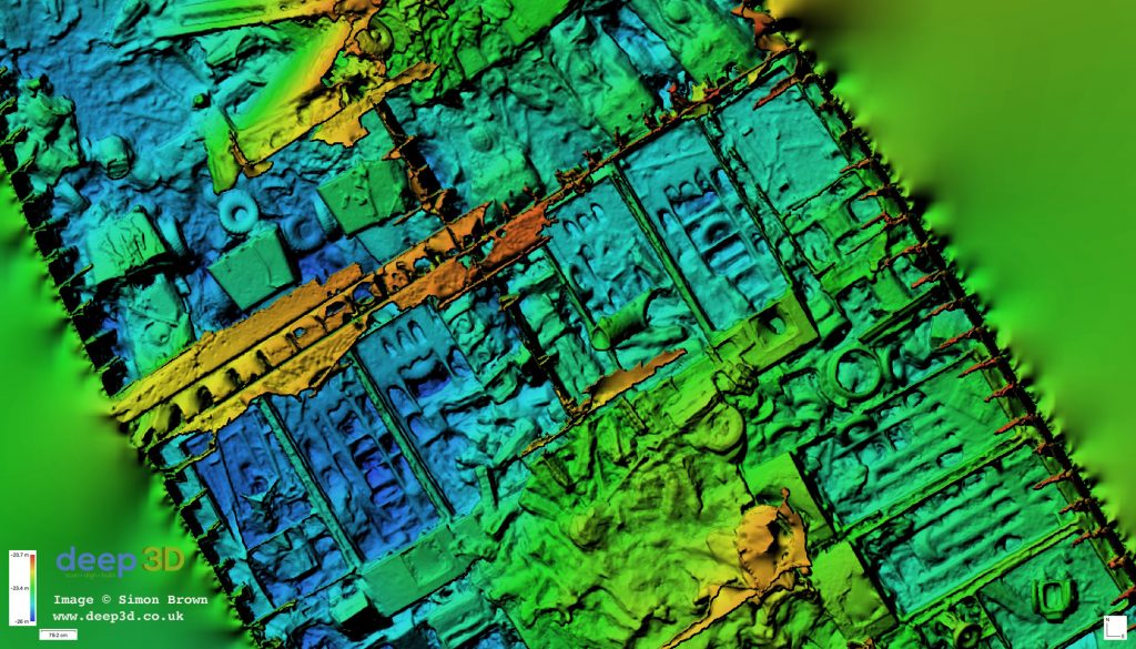
Update – The Captain’s Room

Filling in the Gaps

After scanning the SS Thistlegorm last year we knew  much had been covered, but there were areas missed. The stern crew quarters was one area, and the Captain’s Room another. The crew quarters were a little cramped to squeeze the camera in but the Captain’s Room – the area directly below the bridge – was simply overlooked.

(more…)

Image by Simon Brown/www.deep3d.co.uk

Digital Elevation Models – Data Meets Art

The Data

Digital Elevation Models (DEM) are a very effective way of visually communicating the height of an object. As the colours shift from red (shallow) to blue (deep) the elevation or depth of an object like a wreck on the seabed is quickly understood. With the photogrammetry survey of the SS Thistlegorm extending over 5 acres we can see exactly how the depth water over the ship changes:

(more…)

Project Launch

The time is 01:30am on the 6th October 2017.  This marks the 76th anniversary of the sinking of the S.S. Thistlegorm, and the launch of ‘The Thistlegorm Project’.

An ongoing underwater archaeological survey project recording the remains of the SS Thistlegorm shipwreck in the Red Sea, using cutting edge digital techniques to raise awareness of the wreck and to help ensure it preservation for future generations.


(more…)

Fieldwork Complete

The fieldwork for The Thistlegorm Project is now complete.  The international team of archaeologists, divers and digital technicians are now on their way back to Hurghada ready to begin the task of post processing the several terabytes of data collected over the past 10 days.

(more…)